Big Bear Lake Trails
Your guide to recreational hiking and biking trails in Big Bear.
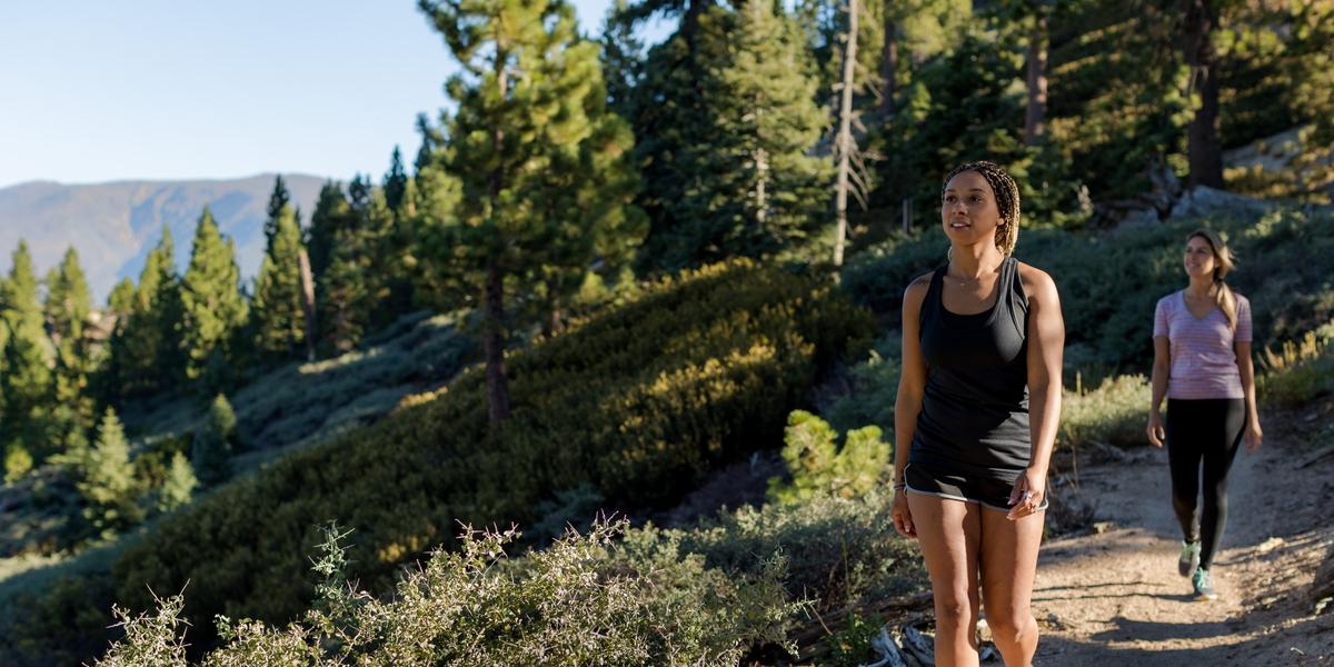
Big Bear Lake sits within the San Bernardino National Forest providing access to over 100 miles of trails open for hiking and biking year-round. The Big Bear valley showcases a range of scenery from thick pine forests to lush green meadows and high desert landscapes. This diverse mountain ecosystem is home to numerous wildlife species and native plants, help us keep it healthy and clean for generations to come:
Big Bear Lake Trail Guide
Before You Go...
Trail Etiquette
Proper etiquette is essential to maintaining the natural environment around wilderness trails. Please:
- Stick to designated trails
- Avoid stepping on wildflowers, bushes, and other plant life
- Do not leave trash along the trails or in the wilderness
- Pick up after pets
- Avoid wildlife you come across on trails
- Learn more about how to Care For Big Bear
Trail Uses
Most of the National Forest trails listed below allow for bikes and horse riding. Trails where these are not permitted are noted on signage and below in the trail descriptions. Motorbikes are only permitted on designated trails. See San Bernardino National Forest - OHV Riding & Camping (usda.gov) for information.
Adventure Passes & When They're Needed
Adventure Passes are required for parking at any U.S. Forest trailheads and recreation areas. Daily Passes are available at the Big Bear Visitors Center. You may also use your America the Beautiful (National Park) Pass. Just leave it on your dashboard before you head out on the trail.
Happy Hills Trail - .2 miles one-way - Very Easy
This wheelchair accessible route is fully-paved. Starting from City Hall, users can admire historical buildings and protected wildlife along the .2 mile stretch and picnic at one of the tables along the way.
Alpine Pedal Path - 2.5 miles one-way - Very Easy
This fully-paved path along the north shore offers spectacular views of the ski resorts and lake. Stroll by beautiful meadows, pine forests, and seasonal wildflowers. Have the kids watch for lizards, squirrels and chipmunks along the way! This route is open to walkers, bikers, joggers, strollers and wheelchairs. Route begins from Stanfield Cutoff and ends near the Solar Observatory.
Stanfield Marsh Boardwalk - Very Easy
The Boardwalk - an extension of the Alpine Pedal Path - crosses the Stanfield Marsh Wildlife and Waterfowl Preserve, a refuge to Big Bear's avian population. Minimal parking is available at Big Bear Blvd and Stanfield Cutoff.
Rathbun Creek Trail - Very Easy
This flat, paved path loops around Moonridge Rd and Sonoma Dr and extends through a wooded area behind Apples B&B and Big Bear Chateau. This route is accesible for strollers and wheelchairs. Parking is easiest at the Elm Street parking lot.
Woodland Interpretive Trail - 1.5 mile loop - Easy
Woodland Trail includes a brochure with 16 posted stops. Pick up a brochure at the Big Bear Visitor Center and start the self-guided tour to learn about the botany, geology and wildlife of the valley. This trail is popular for biking, horseback riding, and introducing little ones to the wonders of nature! Note: Adventure Pass required.
Bristlecone Trail - 1.8 mile - Easy
Easy hiking, biking, and equestrian trail starting and ending off the Fire Service Road near Snow Summit and the Buttercup Campground. This trail connects to the Skyline Trail and 2N10 Fire Road.
Towne Trail - 2.5 mile loop - Easy
Beginning from Snow Summit, Towne Trail weaves through Big Bear’s woodlands with views of the north shore and lake. When the trail forks at 2N08, you can either loop back for a 2.5 mile round trip or take a left and head up the fire road to connect to other trails. Or, head to the right and down to Knickerbocker Road into The Village.
Champion Lodgepole Trail & Bluff Lake Reserve - .6 miles one way - Easy
This pleasant hike through a lush alpine meadow offers a change of scenery to visitors. Bluff Lake is an ecological reserve protecting a vast open meadow highlighted with colorful wildflowers in the spring months. (NO DOGS PERMITTED IN THE RESERVE) Just outside of the reserve sits the famed Champion Lodgepole Pine, one of the valley's oldest living trees. Bluff Lake Reserve is open mid-May through Mid-November. This trail begins at Mill Creek Road (Forest Road 2N10) and continues for 4.5 miles, then turns right on 2N11 and continues for 1 mile to the trailhead. You can also connect to this trail from the end of Castle Rock trail. Note: Vehicles with high ground clearance recommended.
Maple Hills Trails - Easy/Moderate
The Maple Hills trail system sits on private property and public use is dependent upon responsible behavior. Access these trails from Shore Drive or from Big Bear High School. Bikers must yield to hikers and horses, and hikers to horses. Motorized vehicles not permitted and dogs must be kept on a leash. All pet waste must be removed and all trail users agree to respect wildlife and refrain from littering.
Grandview Trail - 9 miles - Beginner/Intermediate
A popular trail for hiking and biking, this adventure starts at Snow Summit with a ride on the Scenic Sky Chair to the top of the mountain. You'll follow the Skyline Trail to Grandview Point Junction. This will be a longer trek, about 7.5 miles. There will be a fork in the trail where you have the option to go .25 miles to Grandview Point or loop back. Note: Dogs are not allowed on the Scenic Sky Chair.
Bobsled Trail - Snow Summit (2 miles, roundtrip) - Medium/Difficult
Make your way to the top of Snow Summit (elev. 8,200 feet) from the base area while traversing the forest canopy. Featuring moderate incline/decline, switchbacks, multiple scenic viewing areas of the Big Bear Valley.
Pine Knot Trail - 6 miles round trip - Intermediate
Pine Knot Trail begins at the Aspen Glen Picnic Area on Mill Creek Road. The trail winds through the forest, crosses the 2N08 and passes the Deer Group Camp. You'll end up at the 2N10 where you can hop on the Grandview Point trail for a .25 mile walk for spectacular views of Mt. San Gorgonio. Note: Adventure Pass required.
Cabin 89 - 2 miles one-way - Intermediate/Difficult
As a hike, Cabin 89 is a moderate to intermediate climb. As a bike trail, steep and rocky sections make Cabin 89 more advanced - both uphill and down. Access is from the Aspen Glen Picnic Area, you will see signs for Pineknot Trail along the way. Note: Adventure Pass required.
Castle Rock Trail - 2.4 miles round-trip - Intermediate/Difficult
Castle Rock is a steep wooded and rocky climb. Cars must be parked in the Trailhead Parking Lot located at Big Bear Blvd and Talbot Dr. Fines administered for parking along SR-18. You may get to watch rock climbers scaling Castle Rock as you make your way up. You can also connect to the Champion Lodgepole Trail from the end of this trail. Note: No bikes on this trail.
Cougar Crest Trail - 5.5 mile loop - Intermediate/Difficult
Travel through a variety of landscapes and keep an eye out for bobcats, rattlesnakes, and other wildlife. The first mile of this trail is a gentle climb before you start gaining altitude. Cougar Crest Trail ends at the junction of the world-famous Pacific Crest Trail. From here you can continue to Bertha Peak, a steep .75 mile hike with sweeping views of Big Bear Valley and the high desert. Note: Adventure Pass Required.
Grout Bay Loop Bike Trail - 13 miles - Intermediate
This hike and bike trail starts from the trail head parking lot, or you can head the opposite way from the Fawnskin Fire Station up to 3N14 to Hanna Flat campground and catch the trail there. The trail climbs and descends through a range of landscapes. Rattlesnakes can inhabit the area so be alert! Note: Adventure Pass required.
Hanna Flat Trail - 7.8 mile loop - Intermediate
Trailhead starts from the Hannah Flat Campground north of Fawnskin. Trek through a variety of landscapes from pine forests, to the sandy and low shrub environments, to lush streams. This trail also connects to Greys Peak.
John Bull Loop Trail - 14.9 miles - Advanced/Expert
To complete this loop you'll need stamina and basic navigation skills. Start at Van Dusen Canyon Rd. (3N09) and head up 3.5 miles to Holcomb Valley to 3N16 turn left, to 3N07 turn right, to 3N43 turn left to "The John Bull Trail" (3N10). It's about 3 miles of venturing before you come to 3N32. Turn right to 3N16, take another right at 3N09 which will lead you back to your starting point.
The Skyline Trail - 15 miles loop - Beginner/Intermediate
The 15-mile iconic Skyline Trail spans the mountainous ridge of the South Shore of Big Bear. Much of the trail parallels the 2N10. To the south you'll catch views of Mt. San Gorgonio and to the north you see glimpses of the lake. Hike or ride the entire length to test your endurance or use various trails and roads to head back to town.
Gold Fever Trail - Self-Guided Driving Tour - 12.3 miles
Go at your own pace on this easy off-road adventure through Holcomb Valley. This scenic route takes you through an area that was thriving with activity during the gold rush of the 1860’s. At 12 selected markers you can get out of your vehicle and walk to the sites. See abandoned mines, grave sites and more. Stop at the Big Bear Visitor Center for brochures and info. Great family adventure. Pets on leash welcome.
Sugarloaf National Recreation Trail - 10 mile loop - Advanced
From Hwy 38 at Hatchery Road, start onto Forest Road 2N93. This is a lengthy and difficult trek to the summit of Sugarloaf Mountain, Big Bear's tallest peak.
Mountain Top Loop - Snow Summit (1 mile, roundtrip) - Easy
As the name implies, the Mountain Top Loop is a one-mile roundtrip trek located at the top of Snow Summit beginning and ending at Skyline Taphouse.